In recognition of the approaching 70th anniversary of the worst flood ever recorded along the Delaware River, the Delaware River Joint Toll Bridge Commission today reissued the brief account of the flood that appeared in the agency’s 1955 annual report:
The most devastating flood of the Delaware River, ever recorded, occurred on August 19 and 20, 1955, presenting many new and challenging problems for the Commission and its Administrative and Engineering Staffs. The United States Weather Bureau had the following explanation of the great flood of the Delaware River:
“The warm moist air mass that had covered this area for days was penetrated by Hurricane ‘Diane,’ which weakened, as its low pressure area moved rapidly from Northern Virginia to Cape Cod. An effect was to force the warm air higher, where it cooled quickly and was unable to hold its moisture. The ground was already drenched from Hurricane ‘Connie’ and there was no place for water to go except in run-offs in tributary creeks of the Delaware and other rivers.”
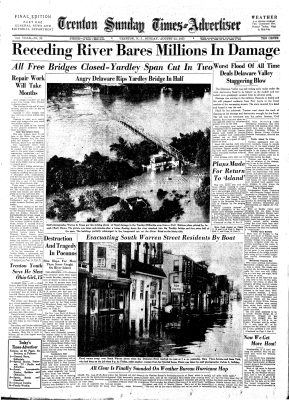
The flood water destroyed four free bridges and caused considerable damage to others. Bridges which were damaged have been partially or totally repaired and opened to traffic. One of the bridges destroyed has been replaced by a temporary Bailey type structure. Another is being replaced by a temporary Bailey structure. That latter bridge between Easton and Phillipsburg will be opened for traffic sometime in March 1956.
The Commission’s high level toll structures were closed for a short period of time as access to the structures was cut off by inundated conditions of state and county highways, and municipal streets. It is worthy to note that the devastating flood did not damage any of the five toll bridges. Minor damage was done to the Pennsylvania approach to the Easton-Phillipsburg (Toll) Bridge. The Trenton-Morrisville Toll Bridge was opened to traffic during the entire flood period and for a few hours was the only river crossing, under control of the Commission, open to traffic.
The 1955 annual report also listed the closure periods at the various non-toll vehicular bridges the Commission controlled at the time of the flood. These bridges were jointly owned by the states of New Jersey and Pennsylvania at that time. The states annually jointly paid the Commission identical sums to operate, maintain, and protect these listed bridges. This funding arrangement ended July 1, 1987, when the Commission was assigned full ownership of the non-toll bridges that were still in service. The 1955 annual report list (current-day notations added in some cases) was as follows:
- Lower Trenton (“Trenton Makes”) – closed on account of flood August 19 to August 22.
- Calhoun Street – (closed at the time of the flood) closed on account of construction of East-West Highway (2025 note: now signed as Route 29 in Trenton) August 8, 1955 to August 31, 1955.
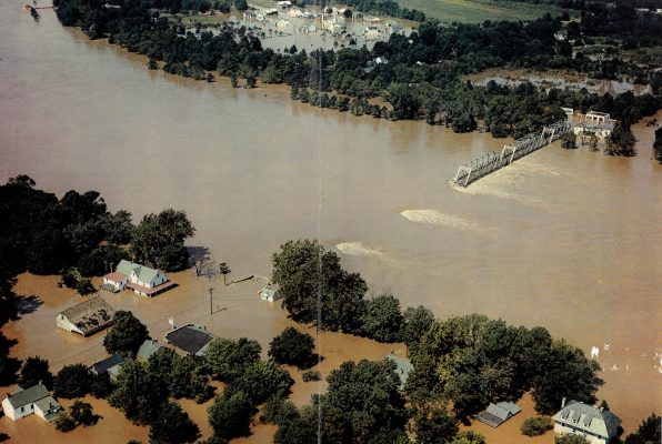
- Yardley-Wilburtha – bridge destroyed, flood August 19-20, 1955 (2025 NOTE – The six-span bridge reopened December 23, 1955 with three surviving spans and three temporary Bailey bridge spans installed by the Army Corps of Engineers. Bridge was removed from service for safety reasons May 3, 1961.)
- Washington Crossing – bridge closed on account of flood damages August 19, 1955 to November 17, 1955.
- Lambertville-New Hope – bridge closed on account of flood damages August 19, 1955 to September 22, 1955.
- Centre Bridge-Stockton – closed on account of flood, August 19, 1955 to August 21, 1955.
- Point Pleasant-Byram – bridge destroyed, flood August 19-20, 1955.
- Uhlerstown-Frenchtown – closed on account of flood, August 19, 1955 to August 22, 1955.
- Upper Black Eddy-Milford – closed on account of flood, August 19, 1955 to August 22, 1955
- Riegelsville – closed on account of flood, August 19, 1955 to August 21, 1955
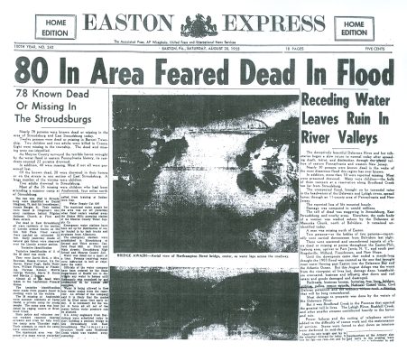
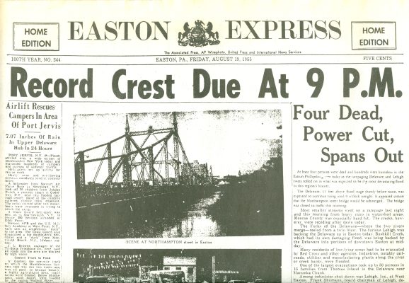
- Easton-Phillipsburg (Northampton Street) – closed on account of flood, August 19, 1955. One span destroyed. Not repaired to December 31, 1955. (2025 NOTE – Two temporary single-lane Bailey bridges were installed at an upriver location, opening to traffic on March 15, 1956. They were removed from service after the Northampton Street Bridge’s central span was reconstructed and opened to traffic October 23, 1957.)
- Belvidere – closed on account of flood, August 19, 1955 to August 22, 1955.
- Portland-Columbia – bridge destroyed, flood of August 19-20, 1955. (2025 NOTE: Bridge became pedestrian-only Dec. 1, 1953; reportedly the longest remaining wooden covered bridge in United States when destroyed at that time.)
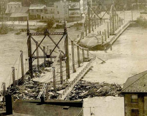
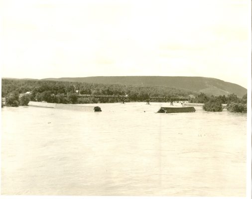
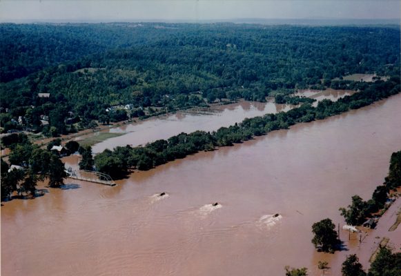
Photos from Commission archives attached –
Easton-Phillipsburg (Northampton Street Bridge)
Portland-Columbia Covered Wooden Bridge (former Lehigh & New England Railroad bridge in background)
Point Pleasant-Byram Bridge
Yardley-Wilburtha Bridge